Turning Pain Points into Partnership
Aug 22, 2025 @ 20:11
- by Uday PatilHow SLR Analytics Empowers Florida Insurers Create Community Value?
Florida’s property insurance market is in a state of volatility. In recent years, a surge of catastrophic hurricanes and chronic flooding has driven many insurers out of the state or into insolvency. Consequently, homeowners’ insurance premiums have skyrocketed, with Floridians now paying around $6,000 per year on average, roughly four times the U.S. national average. This dramatic gap highlights how environmental hazard risk is translating into financial strain for both insurers and consumers. This is not just an environmental issue; it is a market stability issue.
Over 1 million policies have already been shunted into Citizens Property Insurance, the state-backed “insurer of last resort,” making it Florida’s largest insurer and a barometer of market distress. In short, Florida’s beautiful coastlines come with unique insurance challenges, where climate-driven risks are undermining the availability and affordability of coverage. Past legal and regulatory issues exacerbated the problem, additionally Sea Level Rise is emerging as the ultimate threat multiplier.
Current underwriting processes do not address the fundamental, accelerating threat of sea level rise (SLR) accurately enough. The core risk—the increasing frequency, rising water levels demands granular level predictability, this remains unaddressed and is, in fact, accelerating. Due to lack of granular property level insights, current practices are not sufficient to develop and implement new underwriting guidelines and policyholder programs that offer specific discounts and incentives for property-level risk mitigation efforts.
The Pressures on Insurers
Insurers in Florida are grappling with a steep rise in catastrophic (CAT) claims frequency and severity. The past few years have seen record-breaking disaster losses nationwide, with Florida at the epicenter. For example, Hurricane Ian in 2022 caused an estimated $50–65 billion in insured losses, second only to Hurricane Katrina. With climate change warming the oceans, scientists warn that more high-intensity hurricanes and heavy rainfall events are likely, meaning Florida’s insurers face both more frequent storms and costlier damages per storm. In short, the historical models insurers relied on are being challenged by a new era of super-charged catastrophes.
Another pressure point comes from the escalating cost of reinsurance. After recent hurricane damages, global reinsurers have hiked prices and even pulled back from high-risk markets. Florida insurers saw reinsurance costs jump about 27% for the 2023-2024 contract year. In some cases, reinsurers will not extend as much coverage as before, creating a capacity crunch that forces smaller Florida carriers to either non-renew policies or lean more on state programs. This creates a vicious cycle where large payouts drive reinsurance rates up, which then drives primary insurance rates up and pushes some insurers to the brink. Since 2019, Florida has seen at least 10 property insurers go insolvent, often after failing to secure affordable reinsurance following big storms.
Regulatory Alignment: NAIC Climate Scenarios (YE24–YE26)
Regulators are increasingly demanding that insurers move beyond qualitative descriptions of climate risk to quantitative, forward-looking scenario analysis. The National Association of Insurance Commissioners (NAIC) now requires insurers to perform climate scenario analysis as part of their annual financial filings. This regulatory shift is not a one-time exercise; it’s a multi-year requirement. The NAIC has mandated that insurers begin reporting climate-conditioned probable maximum losses (PMLs), a new requirement that became effective with the 2024 year-end Risk-Based Capital (RBC) filing. Regulators are using these climate “stress tests” to gauge which companies might be at risk of failure in the future.
Sea Level Rise as a Predictable Risk Factor
Not all climate threats are as sudden as hurricanes. Sea level rise (SLR) is a slow-moving but predictable force that poses a profound risk to Florida’s coastal properties. Tidal gauges show that sea level around Florida is about 8 inches higher today than in 1950, and the rate of rise is accelerating. Projections indicate the seas will rise another 10–12 inches on average by 2050 along U.S. coastlines—essentially, as much rise in the next 30 years as the previous 100 years.
What does this mean on the ground? We can map the future inundation. By 2050, portions of coastal cities and barrier islands will be chronically underwater at high tide. For example, projections show that large parts of the Florida Keys and Everglades wetlands will be submerged or rendered uninhabitable by 2050.
Crucially for insurers, sea level rise is not a random event but a foreseeable trend. This gives us a chance to plan ahead for shifting risk zones. This is where granular data is key. If underwriting is done only at a coarse ZIP-code level, it will miss critical nuances. Within a single ZIP code, one neighborhood might sit 3 feet higher in elevation than another. Zip-code averaging would mislead an insurer into underestimating the low area’s risk (and overestimating the high area’s risk). Property-level inundation depth and SLR projections are far more precise. Insurers who underwrite with fine resolution can selectively adjust coverage and pricing within a zip code, targeting the true risk.
Data & Methods: AssetRx for your SLR Insight Hub
The shortcomings of traditional underwriting models highlight the pressing need for a new, data-driven paradigm. The solution lies in leveraging advanced analytics to move beyond static, imprecise data and incorporate dynamic, property-level information.
Inputs
A modern analytics platform creates a virtual “digital twin” of a property, incorporating its exact inundation depth, building footprint, occupancy class, and a host of other property-specific characteristics. This process requires a multitude of data points, including:
- High-Resolution Elevation Data: Digital Elevation Models (DEMs) with 3-meter resolution are used to pinpoint the precise elevation of a property and its surroundings.
- Building Footprints: Rather than relying on a parcel centroid, the actual building footprint provides a precise location for risk assessment. A detailed analysis revealed that over one million buildings in the U.S. would be underpriced for flood risk if relying on parcel centroids alone.
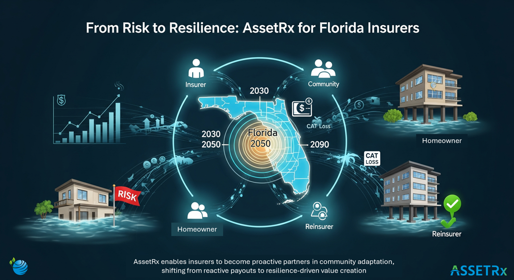
- NOAA and FEMA Projections: Data from federal agencies like NOAA has been incorporated into AssetRx platform to provide clear projections for future inundation under various climate scenarios for 2030, 2050, and 2090.
- Tide Gauges: Data from local tide gauges helps to model the frequency and severity of minor tidal flooding.
- Road Network: Additionally, an accurate road network is essential to assess “connectivity risk,” as a home’s accessibility to predict indirect impact is a key factor in its insurability.
Outputs
By leveraging these inputs, our AssetRX, a data-driven platform, can generate a precise, property-specific risk score. The key outputs for an insurer include:
- Property-Level Risk Scores: AssetRx generates scores for each property reflecting its long-term risk from sea level rise and coastal flooding. These scores incorporate factors like the property’s elevation and distance from tidal waters, allowing insurers to pinpoint which neighborhoods or even which streets are most exposed. This granularity means underwriters can make data-driven decisions at the point of sale.
- Inundation Depth Modeling: Beyond a yes/no flood zone, AssetRx data provides estimated inundation depths for properties under various scenarios. This depth insight is crucial for pricing and reserves, as a few inches of flooding can be very different from a few feet.
- Indirect Impact Analysis: AssetRx evaluates indirect risks, like whether the access roads to a community would be cut off by flooding. A home might be safe on a slight hill, but if the only access road floods in minor storms, it becomes effectively high risk because emergency services can’t reach it.
- Scenario Modeling for Premium Strategy: AeestRx’s data platform allows insurers to play out “what if” scenarios easily, helping them set today’s premiums at adequate levels. By integrating climate projections into pricing, insurers avoid the shock of sudden rate jumps and can smooth the transition to risk-reflective pricing over time.
- Economic Loss Values: The ability to “financialize” physical climate risks by translating them into quantifiable financial loss metrics at both the portfolio and asset levels is a core capability.
What does this mean for your customers
Precision helps more than the balance sheet. Customers who live just beyond the lowest streets shouldn’t be priced as if they’re on the water. With property‑level insight, you can keep good risks covered, nudge high‑risk households toward practical mitigations, and sustain availability in communities that need it. That’s resilience in action—measured not by a ribbon‑cutting, but by renewals that remain affordable.
Implementation Playbook: Into the Underwriting Stack
The value of granular data is amplified by its seamless integration into existing underwriting software and workflows. This automation reduces human error, cuts down on the time and cost of manual inspections, and allows underwriters to focus on the most complex cases.
API Wiring: Where to Surface Flags in Quoting
The data can be made accessible through API integrations and user-friendly software dashboards. Underwriters and agents can have risk indicators appear directly in their workflow.
Example Trigger: If a property is flagged with an “SLR Risk: High” status (e.g., projected inundation of ≥2 ft by 2050), the system can automatically trigger a referral to an underwriter or mandate a higher deductible. This empowers underwriters to transition from a clerical role focused on data entry to a strategic one, using advanced analytics to make more defensible and profitable decisions.
Rules Examples
- Declination/Conditions: For parcels with a projected inundation depth of 1 foot or more by 2050 and single-road access, an insurer can set a rule to decline new policies or require specific conditions, such as verification of flood insurance.
- Credit Tiers for Mitigations: Florida has long required insurers to offer discounts for homes that have installed wind mitigation features. This model can be extended to flood mitigation efforts. By calculating the reduced risk for a homeowner who raises their foundation or installs flood vents, insurers can offer meaningful premium discounts.
- Batch Back-testing: Insurers can back-test their existing portfolios to identify properties that are mispriced due to outdated underwriting methods. The data could reveal that some properties, despite being in a high-risk ZIP code, are on elevated ground or have hip roofs that better withstand hurricanes, making them profitable to underwrite. This capability transforms the insurer from a passive underwriter into a strategic risk manager.
Reinsurance Strategy: Using Asset-Level to Defend the Tower
The success of Florida’s legal reforms has led to a dramatic shift in the reinsurance market, with reinsurers now seeking to expand their portfolios in the region. At the mid-year 2025 renewals, reinsurance buyers found ample capacity, and overall risk-adjusted rates saw decreases in the high single digits, with an average reduction of -10.7% across all layers.
This demonstrates that the reinsurance market has validated the effectiveness of the legislative reforms and provides a critical opportunity for carriers to strengthen their financial position.
Granular data allows insurers to make surgical, data-backed decisions about their exposure, rather than making broad, inefficient retreats from entire communities. By accurately identifying loss hotspots, insurers can make more informed decisions about their reinsurance attachment points and purchases. This is particularly important for defending their “tower” of coverage and securing more favorable terms and pricing from reinsurers who are now competing for market share.
3 Steps to Using SLR Data for Smarter Underwriting
The path forward is about precision and proactiveness. By embracing data-driven tools, insurers can chart a sustainable path. The goal is to transition from a reactive posture to a resilient system where risks are known, managed proactively, and shared appropriately between insurers, policymakers, and homeowners.
- Assess: Leverage high-resolution climate data to map out which properties and infrastructure face rising sea level and flood risks. Identify “hotspots” of risk at the property level, not just broad zones.
- Adjust: Refine your underwriting guidelines and pricing based on this data. Avoid or restrict the very highest-risk locations, and set premiums that account for future risk trajectory, not just yesterday’s experience.
- Adapt: Work with policyholders and communities on mitigation. Offer incentives like premium discounts or grant support for homes that elevate or take adaptive measures. For example, insurers can offer premium credits for homes that are elevated or have flood-proof features. Support local adaptation projects and incorporate their impact into your risk models so that customers see the benefit.
By following these steps, insurers can transform sea level rise from an existential threat into a manageable risk factor. This transforms the insurer’s role from a passive underwriter to an active partner in resilience, creating a new source of value for the business and the community..
Ready to Create Community value through your SLR Analytics?
If you’d like to see how your book behaves under property‑level SLR and access signals, we’ll start where it matters: your addresses, your appetite, your reality. We can provide a certified single‑property report for a live file, or a county‑level API/CSV sample you can drop into your sandbox and review with your team.
Talk to TECHG‑X about putting AssetRx into your underwriting and portfolio workflow.