Beyond the Waterline: Redefining Sea Level Rise Flood. Risk Through Indirect Impact
Apr 15, 2026 @ 12:25
- by Premkumar SWhen we discuss Sea Level Rise (SLR), the imagery is almost always visceral: waves breaching a front door, or a basement submerged under feet of silt. Conventionally, we measure the success of flood mitigation by answering a simple question: Did the drywall stay dry?
This question focuses on the direct impact of the flood, but it remains not enough.
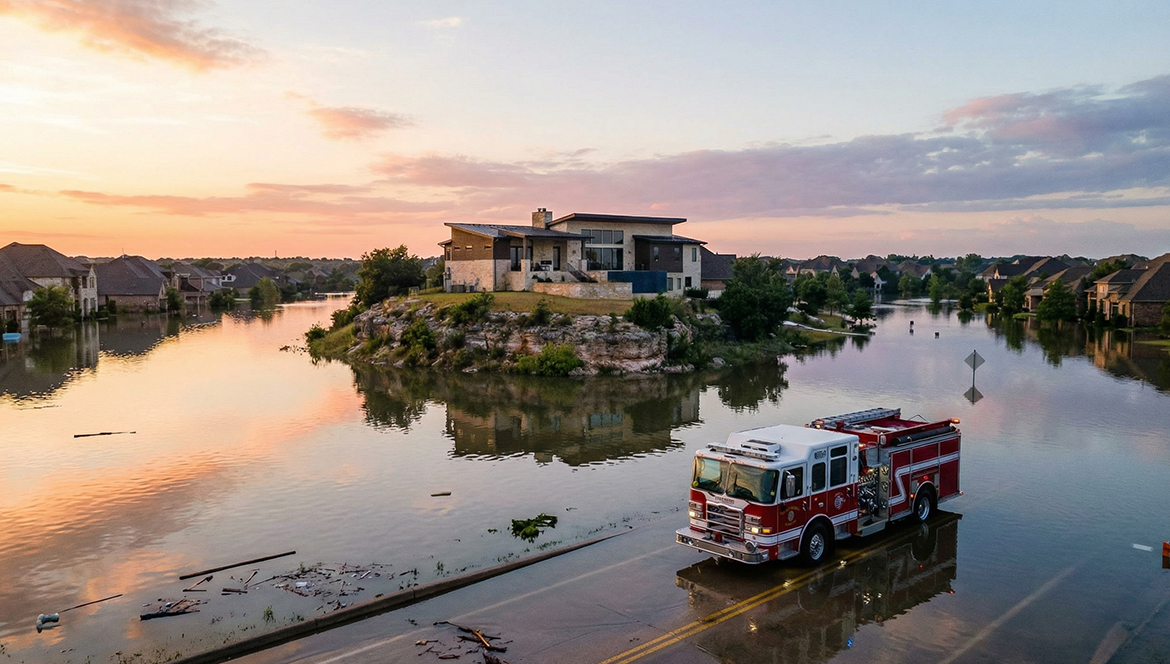
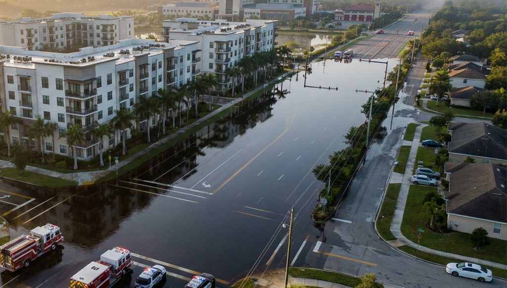
For a family trapped on an “island” of dry land because every surrounding street has become a river, or for a fire truck unable to reach an emergency site due to submerged asphalt, the damage is just as devastating.
This is the reality of Indirect Impact. A building does not need to be touched by a single drop of water to be effectively “lost.” When the infrastructure supporting a structure, the roads that provide food, emergency services, and mobility are compromised, the building’s functionality vanishes.
The “Last Mile” of Structural Vulnerability
To refine the precision of climate adaptation strategies, we must shift from macro-topographical assessments to a micro-scale Network-Building Functional Dependency. The concept of Immediate Access Segments serves as the critical link in this analysis, identifying the specific “Last Mile” infrastructure that dictates a building’s operational viability.
1. Defining the Immediate Access Segment
The Immediate access segment is the fundamental unit of geographic analysis that connects a private parcel to the public transportation network. By utilizing a bifurcated buffer approach, we can account for the differing urban and rural morphologies:
- Urban Micro-Buffer (25m): In high-density environments, the proximity of structures to the curb is minimal. A 25-meter radius captures the primary street frontage and any immediate alleyways or secondary access points. This precision is necessary to differentiate between a building that is accessible via a side street, even if its main thoroughfare is flooded.
- Rural Macro-Buffer (50m): Rural structures often feature significant setbacks and longer private or semi-private driveways. A 50-meter buffer ensures that the intersection of the private driveway and the nearest public collector road is captured, identifying the singular points of failure common in low-density networks.
The Anatomy of SLR Risk: Measuring the “Drowned” Road
To transform a flooded street into actionable data, we developed the Road Inundation Ratio. Think of this as a stress test for a street. Rather than just asking “How deep is the water?”, it asks: “How much water can this specific road handle before it fails?”
Every road has a “breaking point”, a critical flood tolerance threshold. A massive interstate can withstand more stress than a narrow residential alley. Our ratio measures the gap between current flood levels and that specific breaking point, allowing for:
- Functionality Checks: Pinpointing the exact moment a road shifts from “slow but drivable” to “completely cut off.”
How does this bring a change in the Impact Score?
We’ve replaced guesswork with a simple, three-step logic to determine a building’s Total Indirect Impact Score:
- The Road Importance Factor: Not all roads are equal. We prioritize them based on their “job.” A flooded highway paralyzes an entire region, while a flooded alley only affects a few. We weigh the risk based on whether the road is a vital artery for the city or a secondary path.
- The Building Dependency Factor: A road’s importance is defined by what sits at the end of it. We ask: How critical are the buildings that rely on this street?
- High-Priority Lifelines: If a road is the sole access point for a hospital, fire station, or water treatment plant, its “importance weight” skyrockets.
- Secondary Paths: Roads leading to non-critical structures (like storage sheds) are weighted differently to reflect their lower impact on community safety.
The Bottom Line: Dry Buildings Don’t Exist in a Void
A dry building is only truly safe if the road it relies on is functional. By shifting our focus from “wet floors” to “functional access,” we provide a more honest assessment of climate risk. This data-driven approach ensures that we prioritize the protection of the places we need most—our clinics, our utility hubs, and our homes.