Beyond the Legacy GIS Bottleneck: Why the Industry is Shifting to Geospatial Intelligence Platforms
Apr 5, 2026 @ 13:39
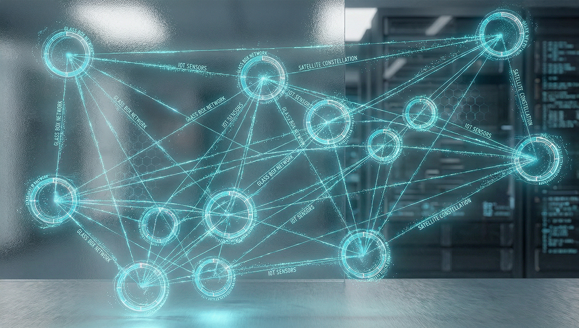
- by adminTGXWe are currently living in the most data-rich era in human history. Between a growing constellation of high-resolution satellites, a global network of IoT sensors, and the explosion of mobile location data, we have more “pixels” and “points” than people on the planet. For a geospatial professional, this should be a golden age—a time of unparalleled insight and rapid problem-solving.
Yet, if you speak to any senior GIS engineer or climate researcher, the sentiment is rarely one of triumph. Instead, it is one of exhaustion.
The industry has hit a wall. Despite the sophistication of our data, our workflows remain tethered to a legacy paradigm. We are trapped in what we call the “80/20 Trap”: a reality where the world’s most brilliant spatial minds spend 80% of their week acting as “data janitors”—cleaning CSVs, fixing projection errors, and navigating fragmented software interfaces—leaving only 20% of their time for actual science and impact.
To move forward, we must engage in The Great Unlearning. We have to let go of the idea that manual complexity equals professional value. The shift from traditional desktop GIS to a modern Geospatial Intelligence Platform isn’t just a software upgrade; it is an evolution of the entire discipline of spatial engineering.
The Hardware Ceiling: Why Desktop GIS is Fainting
The primary culprit behind current GIS bottlenecks is the persistent “desktop-first” mindset. Traditional GIS software was designed for an era where data was gathered in the field, stored on local disks, and processed on a single workstation. In that world, the limit of your analysis was the limit of your RAM.
Today, we are operating in a reality of massive, multi-source geospatial datasets. When a climate risk team needs to analyze urban heat islands across an entire coastline, or an infrastructure group needs to model fire station coverage for a rapidly growing metropolis, they aren’t dealing with a few shapefiles. They are dealing with massive datasets that local hardware simply wasn’t built to ingest, let alone analyze.
When you hit this hardware ceiling, your workflow doesn’t just slow down; it breaks. You see the spinning wheel of death. You experience workstation crashes during a critical spatial join. You spend hours “tiling” data just so your software can render it. These aren’t just technical glitches; they are fundamental barriers to innovation.
Relying on a single PC to process the world’s most complex spatial challenges is like trying to map the ocean with a magnifying glass. It is time to shift to cloud-native GIS—where the processing ceiling is removed, and the focus returns to the logic of the problem, not the limits of the hardware.
Defining the Geospatial Intelligence Platform
The industry is currently being flooded with “AI GIS” tools that promise magic results with a single click. But for a professional engineer, “magic” is a liability. You cannot base a multi-million dollar infrastructure project or a city’s resilience plan on a “black box” that gives an answer without showing its work.
This is why we distinguish between a simple AI tool and a Geospatial Intelligence Platform.
GriidAi is a dynamic orchestrator. Driven by a core orchestration engine, the platform doesn’t replace the expert; it provides the intelligent framework for their expertise to scale. It handles the “messy middle” of the spatial analysis lifecycle—the fetching, joining, and cleaning—allowing the expert to lead with their mind rather than their mouse.
Instead of an analyst spending three days manually fetching data, re-projecting layers, and running a series of disjointed geoprocessing tools, they simply declare their intent through a natural language prompt. The platform then takes that high-level goal and breaks it down into a structured, multi-step pipeline of prompt-driven orchestration.
The difference is profound:
- Desktop GIS requires you to navigate the tool.
- Geospatial Intelligence Platforms allow you to orchestrate the outcome.
When the Platform Becomes a Spatial Research Partner
In more complex, domain-specific analyses, the role of the platform extends beyond executing explicit instructions. A geospatial intelligence platform acts as a Spatial Research Partner, assisting in researching the problem space, identifying relevant datasets, and proposing a structured workflow before any processing begins.
Rather than forcing the analyst to start from a blank canvas, the system helps frame the analysis, surface appropriate data sources, and outline the sequence of spatial operations. For example, if an analyst is tasked with identifying flood vulnerabilities in a newly developed urban corridor, they no longer need to manually hunt for the latest elevation models or historical rainfall data. Through a natural language interface, they can ask the platform to identify the necessary parameters.
The system then proposes a workflow, identifying the most relevant multi-source datasets and the optimal sequence of spatial joins. This leaves the expert to review, refine, and guide the final execution—effectively moving the professional from “searcher” to “verifier.”
The Core Pillars: Orchestration, Transparency, and Agnostic Design
The shift to this new category is built on three essential pillars that address the core failures of the legacy GIS model.
1. Data Orchestration over Tool Navigation
In a traditional workflow, every step is a manual hurdle. You find the data, you check the format, you fix the geometry, you run the buffer, you perform the join. Each of these steps is a potential point of failure. GriidAi treats these steps as subtasks within a larger mission. By using spatial engineering principles, the platform automates this orchestration, allowing the user to move from Intent to Insight in a fraction of the time.
2. The “Glass Box” (Human-in-the-Loop)
Professional-grade spatial analysis requires certainty. This is why a true platform must be a “glass box,” not a black box. Before a single operation is executed, GriidAi generates an Execution Plan. This is a transparent logic map that shows exactly which datasets will be fetched and what spatial operations will be performed. The expert remains in the loop—reviewing, editing, and verifying the plan. This ensures that the final output isn’t just “fast,” but scientifically valid. We are moving from blind automation to verified orchestration.
3. Agnostic Architecture (No Vendor Lock-in)
The era of being trapped in a single software ecosystem is over. A modern platform must be technology-agnostic. Whether you are using vector or raster data, or a specific spatial engine, the platform acts as the “universal translator” that brings them all together. The future of the industry is open, interoperable, and cloud-native.
The “Great Unlearning”: A Call to the Experts
For many veterans in the field, this shift can be uncomfortable. There is a certain pride in mastering the arcane complexity of legacy GIS software—in knowing exactly which obscure menu to click or which Python script to write to fix a broken topology.
But we must ask ourselves: Is our value as professionals tied to our ability to navigate a difficult interface, or is it tied to the impact of our analysis?
The Great Unlearning is the process of realizing that complexity for its own sake is a bottleneck. By letting a Geospatial Intelligence Platform handle the 80% of manual engineering, you aren’t “losing control.” On the contrary, you are gaining the ability to work at a scale that was previously impossible.
You are moving from being a Tool Operator to being a Spatial Architect.
An architect doesn’t spend their day cutting individual pieces of wood; they design the structure and ensure the integrity of the build. Similarly, a spatial architect uses a platform like GriidAi to design complex, multi-layered workflows that can be reused, shared, and scaled.
Conclusion: Scaling Ambition
The challenges facing our world—sea-level rise, urban density, and infrastructure decay—are accelerating. Our response cannot be limited by the speed of a progress bar on a local workstation.
The shift to Geospatial Intelligence Platforms is about more than just efficiency; it is about sustainability. When we build modular, reusable “logic blocks” instead of one-off manual workflows, we are creating a compounding library of knowledge that saves compute energy and prevents redundant effort.
The “Great Unlearning” is not a surrender of professional control; it is the ultimate expansion of it. It is the moment we stop fighting our tools and start orchestrating the solutions our world requires. The bottleneck isn’t our data, and it isn’t our expertise. It’s the legacy paradigm we’ve been forced to operate within.
The era of the “data janitor” is ending. The era of the Spatial Architect has begun. Join GriidAI to be among the first wave.