The Illusion of Density: How the “More Data” Trap Hijacks Enterprise GeoAI Decisions
Jul 27, 2026 @ 11:15
- by adminTGXWe live in an era where we are conditioned to believe that more is always better. In the rapidly evolving fields of spatial data science and geospatial artificial intelligence (GeoAI), this bias is incredibly prevalent. When it comes to data, our instincts tell us that higher resolution, tighter focus, and sharper detail will naturally lead to superior answers.
This instinct is exactly what traps enterprise spatial teams, drains corporate budgets, and ultimately hijacks high-stakes decision-making.
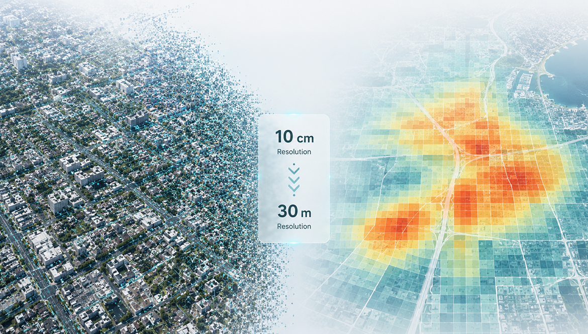
Imagine a scenario where a local government hands your team a massive, high-stakes project: they need a comprehensive energy efficiency analysis covering the entire 500-square-mile metropolitan area. The intuitive move for many analysts is to grab the highest quality data available. You log in to your data provider and download ultra-crisp, 10-centimeter satellite imagery to map the city, thinking this hyper-detailed view will guarantee an airtight, irrefutable report.
But applying 10-centimeter imagery to a citywide analysis won’t make your project better; it will actively ruin it.
By treating spatial models as massive vacuums for granular data, we have created an illusion of density. We confuse the volume of data with the quality of the insight. It is time to address the “More Data” trap, understand the limits of automated scale, and define the architectural rules that separate amateur mapmaking from enterprise-grade geospatial intelligence.
The Seduction of Ultra-High Resolution
The seduction of ultra-high-resolution spatial data is easy to understand. Visually, a 10-centimeter raster dataset looks stunning on a monitor. It provides an immediate sense of omniscient clarity. You can see the exact dimensions of a crosswalk, the shadow of a streetlamp, and the individual cars parked in a driveway.
For executives and stakeholders outside of the geospatial profession, this visual density is often mistakenly equated with scientific rigor.
However, the moment you load that file into your geospatial pipeline for a regional analysis, your system chokes. That massive file size paralyzes your computational processing. Because you have demanded that the software calculate the geographic reality of every single square decimeter across a 500-square-mile expanse, you end up exhausting your project budget just during the data preparation phase alone.
More importantly, you trigger a massive failure in analytical clarity. Ironically, all that microscopic detail actually obscures the macro-level answers the government originally asked for.
In spatial analysis, maximum detail does not equal maximum clarity. More often than not, it just generates paralyzing noise.
The Computational Cost and “Data Noise”
To understand why this happens, we must look at the mechanical reality of spatial processing. Authoritative geospatial documentation explicitly outlines this trade-off, warning that higher spatial resolution demands exponentially more computer storage, heavily extends processing time, and must be intentionally minimized to avoid overwhelming technical infrastructure.
At a massive scale, 10-centimeter data is a computational nightmare. You are forcing the software to render and calculate millions of tiny, irrelevant objects—individual cars, trash cans, and pedestrians crossing the street.
This is what we call data noise.
When you retain all that micro-level detail in a macro-level model, it actively hides the larger heat, demographic, and energy trends the government actually needs to see to make their policy decisions. You cannot observe the overarching thermal performance of a municipal district if your algorithm is distracted by the shifting shadows of a single tree canopy. By asking the machine to look at everything, you guarantee that it comprehends nothing.
The Golden Rule: Matching Resolution to Decision Scale
To avoid this trap, professional workflow architects rely on a golden rule of spatial logic: The resolution of your data must perfectly match the scale of the decision you are trying to make.
Spatial data is a specialized tool that must be intentionally calibrated for each specific use case. As you move up in geographic scale, you have to intentionally blur the raw data to reveal the usable patterns underneath.
Let’s look at how this axis works across three distinct tiers of spatial decision-making:
1. The Micro-Scale (10-Centimeter Resolution)
Ultra-high resolution has a distinct and highly valuable purpose when the decision itself is microscopic.
- The Use Case: Suppose you are inspecting individual rooftops for solar panel viability.
- The Application: Here, 10-centimeter resolution is exactly what you need. You must explicitly identify small geometric features like chimneys, HVAC units, and roof angles to see if solar panels will actually fit on the structure. The analysis requires extreme density because the physical constraints of the decision are measured in inches.
2. The Meso-Scale (1-Meter Resolution)
When the decision expands from a single building to an entire neighborhood block, the data must abstract to match.
- The Use Case: The task is a neighborhood-level decision about where to plant trees to maximize street cooling.
- The Application: If you use that same 10-centimeter data here, it fails. Your software wastes computational power tracing tiny, shifting shadows, missing the forest for the trees. Instead, one-meter resolution is the sweet spot. It successfully abstracts chaotic details into clean, mathematically useful canopy shapes covering the block, allowing planners to calculate the exact percentage of shade coverage without crashing the engine.
3. The Macro-Scale (30-Meter Resolution)
When the decision impacts an entire region, county, or state, granular detail becomes your enemy.
- The Use Case: Returning to the 500-square-mile citywide energy analysis.
- The Application: The correct approach is executing this citywide analysis using a broader dataset, specifically 30-meter resolution. By using 30-meter blocks, the chaotic street-level data smoothly aggregates into a clear heat map. It instantly highlights the regional energy efficiency gaps, and it does it without crashing your software.
By deliberately downgrading the resolution of the data, you actually upgrade the accuracy and the speed of the final decision.
The Generative AI Blindspot
Falling for the more-is-better trap has always had real professional consequences, leading to catastrophic losses in project time and completely blown budgets. However, this vulnerability is especially critical today due to the rapid rise of Agentic GIS and GeoAI.
Modern AI systems can instantly download massive, hyper-detailed datasets at scale, but they currently lack the contextual awareness to question if that scale is actually appropriate for the task.
An AI algorithm is a powerful, compliant execution engine. If you ask a generative model to map flood risks across a coastal state and feed it 10-centimeter LiDAR data, it will not pause to warn you about data noise. It will blindly attempt to calculate the hydro-routing of billions of individual pixels until the cloud server times out or your processing costs skyrocket into the thousands of dollars.
An AI does not understand the difference between a micro-scale engineering challenge and a macro-scale policy decision. It only sees arrays of numbers.
The Ultimate Guardian of Spatial Truth
This is exactly where human judgment becomes irreplaceable.
As the mechanical execution of software becomes fully automated, the value of the geospatial professional shifts entirely. You are no longer paid to operate the tools; you are paid to architect the logic. The ability to look at a client’s core question, decompose it, and intentionally select the correct data threshold is a skill an automated system cannot replicate.
Ultimately, professional expertise is defined by the wisdom to choose the exact resolution that solves a problem, regardless of how much granular data is available.
If you are ready to stop fighting the noise and master the architectural logic that machines lack, it is time to upgrade your spatial strategy. The GriidAi Academy was built to teach exactly this level of workflow architecture. In Module 2, we strip away the software and dive deep into how to navigate global databases, audit metadata, and bypass the “More Data” trap.
Enroll in the free GriidAi Academy Masterclass today and step into the Spatial Age.